|
||||||
|
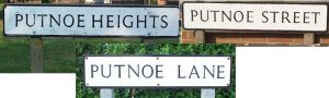
Putnoe was listed in the Domesday book: Putenehou: Hugh de Beauchamp. Mill. Part of Bedford. The name in its present form has been around since the 16th Century, but was formely known as 'Puttenhoe' and 'Putenho' indicating the spur or 'hoh' of land belonging to an unknown Anglo-Saxon settler Putta, hence 'Puttas-hoe' => Putnoe! Situated on the northern side of Bedford, the manor of Putnoe was formerly part of Goldington Parish. Since 1934 it has been within the Borough of Bedford, and became a mainly residential area during the 1950s. The current Putnoe parliamentary ward covers 512 acres and is populated by almost 7000 people.
Putnoe is bounded by the ancient Elm woodland of Putnoe Wood and Mowsbury Park to the North, the residential estate of Goldington to the East, Polhill Avenue to the South and Kimbolton Road (B660) to the West. This site provides information past & present about Putnoe. If you live in the area then why not join me in the compilation of these pages. Advertise your local club, society, event or business. Any constructive criticism, new ideas, additions or amendments please contact me. |
|||||
|
View Putnoe (Bedford) 5 day weather forecast from: |
||||||
|
We
make every effort to maintain the accuracy of the information on this
Web. However, we cannot accept responsibility for any loss or
damage which may occur from its use. If you see anything which
you think is inaccurate or misleading please contact
us.
Copyright © 2002, 2003, 2004, 2005, 2006, 2007, 2008, 2009 These pages, unless otherwise stated, are copyright protected. |
||||||