|
||
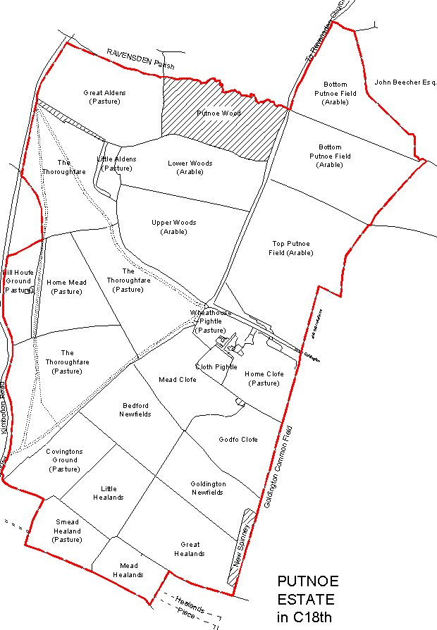
This is a map of Putnoe Manor towards the end of the 18th Century. The field names, field use and boundaries are indicated. The hatched areas are woodland. The extent of Putnoe Wood is very similar to present day. Putnoe farm was located by Wheathouse Pightle, Cloth Pightle and Home Clofe. Note that in the 18th Century 'f' was used in some words in place of 's'. The red line on this map indicates the boundary of Putnoe Manor at this time. To down load a .pdf version of this map click here (Requires Acrobat Reader to view). |
||
|
We
make every effort to maintain the accuracy of the information on this
Web. However, we cannot accept responsibility for any loss or
damage which may occur from its use. If you see anything which
you think is inaccurate or misleading please contact
us.
Copyright © 2002 These pages, unless otherwise stated, are copyright protected. |
||