|
||
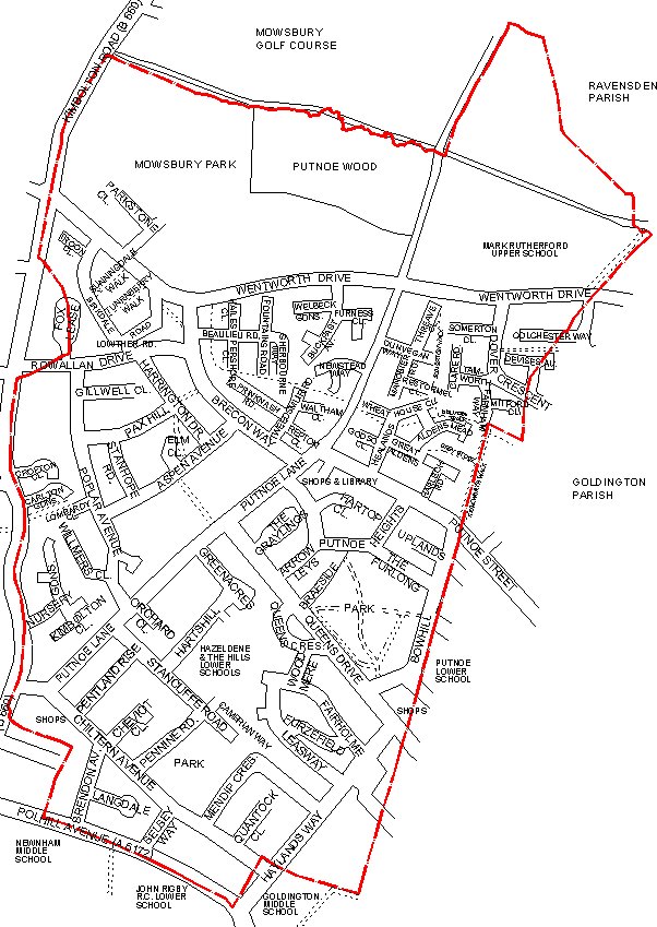
Current and historical maps of Putnoe in Bedford.
Current Map of Putnoe (Drawn 2002): The red line on this map indicates the boundary of Putnoe Manor in the 18th Century. If you have ever wondered where Putnoe stops and Goldington starts then this map is as good a guide as any. |
||
|
We
make every effort to maintain the accuracy of the information on this
Web. However, we cannot accept responsibility for any loss or
damage which may occur from its use. If you see anything which
you think is inaccurate or misleading please contact
us.
Copyright © 2002 These pages, unless otherwise stated, are copyright protected. |
||